Daily SatPaths
Daily SatPaths
Daily Satellite Paths predictor
- Version:
1.0.3-beta (Latest)
- Product type:
Data service
- Update frequency:
Daily
Provisional product
This is a provisional product, meaning it has not yet passed quality control and/or been finalised for release.
About
Geoscience Australia’s predictive schedules for public good satellites over Australia.
Access the data
For help accessing the data, see the Access tab.
See it on a map
Access the API
Key details
DOI |
|
Licence |
Cite this product
Data citation |
Geoscience Australia, 2022. Geoscience Australia's predictive schedules for public good satellites over Australia. Geoscience Australia, Canberra. https://dx.doi.org/10.26186/146512
|
Background
Every day more than a dozen foreign-operated, public-good, non-commercial, medium to low resolution satellites fly over Australia and its territories. They cross the continent several times a day and their sensors capture images of the land and coastal waters.
Satellite overpass schedules for each spacecraft are predictable and can be calculated with a degree of accuracy. The Daily SatPaths provides information on which satellite sensors have and will potentially acquire data over Australia during a given date and time interval. It is important to note that actual acquisition schedules may differ from those presented in Daily SatPaths due the operational limitations of the satellite.
What this product offers
Daily SatPaths calculates date-specific predicted schedules for flyovers over Australia for 19 of the most popular public good satellites used by researchers in academia, and by public and private sector organisations.
The data can be displayed on an interactive map, the portion of Australia that is “visible” to those satellite sensors on each flyover (i.e. the so-called “ground footprint”).
The flight path schedules and sensor specific footprints can be downloaded in a tabular format (.csv file) and polygons in GeoJSON format for use in GIS software.
Applications
The information helps to answer three basic questions:
What satellites are flying over Australia on a particular day, where and at what time?
Which satellite sensors will potentially acquire data over an area of specific interest?
Which ground stations in the Australian National Ground Segment Technical Team ANGSTT network those satellites are visible from, hence which of those stations could potentially downlink the data?
Technical information
Daily SatPaths calculates predictive schedules for flyovers over Australia and ground footprints for selected sensors (in most common mode of acquisition) on board the following non-commercial, public good, mid to low resolution orbiting satellites operated by USGS, NASA, NOAA and ESA:
MODerate resolution Imaging Spectroradiometer (MODIS)
AQUA: 2,330km swath
TERRA: 2,350km swath
Advanced Very High Resolution Radiometer (AVHRR)
NOAA 15: 2,940km swath
NOAA 18: 2,940km swath
NOAA 19: 2,940km swath
METOP-A: 2,900km swath
METOP-B: 2,900km swath
METOP-C: 2,900km swath
Visible Infrared Imaging Radiometer Suite (VIIRS)
NOAA 20: 2,940km swath
Suomi NPP: 3,040km swath
Landsat
Landsat 7 (ETM+): 185km swath
Landsat 8 (OLI): 185km swath
Landsat 9 (OLI): 185km swath
Copernicus Programme
Sentinel 1A (C-SAR): 250km – Interferometric Wide Swath Mode
Sentinel 1B (C-SAR): 250km – Interferometric Wide Swath Mode
Sentinel 2A (MSI): 290km swath
Sentinel 2B (MSI): 290km swath
Sentinel 3A (SLSTR): 1,270km swath
Sentinel 3B (SLSTR): 1.270km swath
Predictive schedules are calculated for seven Australian ground stations which are participating in the ANGSTT network:
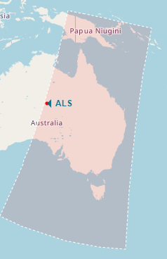
Alice Springs (ALS), operated by Geoscience Australia
Cleveland Bay (CFQ), operated by Australian Institute of Marine Science
Cribb Point (CPT), operated by Australian Bureau of Meteorology
Hobart (HBT), operated by CSIRO
Learmonth (LMO), operated by Australian Bureau of Meteorology
Murdoch (MUR), operated by Landgate
Shoal Bay (DAR), operated by Australian Bureau of Meteorology
The timing and footprints of satellite overpasses are calculated based on the parameters specified in a two-line element set (TLE) from space-track.org. These parameters are updated once a day and are republished in a text file by Geoscience Australia as a free service.
Lineage
Information on start and end times for satellite flyovers, as well as position of satellites at a given time, are generated in real-time based on the most relevant two-line element set (TLE) data from spacetrack.org and jspredict library with algorithms ported from Predict open source tracking and orbital prediction software (https://www.qsl.net/kd2bd/predict.html).
Ground footprint information is generated based on published, sensor specific swath widths, using general purpose ellipsoidal geometry spatial libraries latlon-ellipsoidal.js and latlon-vincenty.js .
Software
Daily SatPaths single page application is written in HTML5 and JavaScript.
It uses third party data and open source libraries, including:
TLE information from SpaceTrack.org
ground station locations from angstt.gov.au
base map by OpenStreetMap contributors
SatPaths API is written in Python. Calculations are based on the PyPredict library.
Accuracy
Flyover schedules are only indicative of potential acquisitions and will differ from what is actually downlinked from satellites by each ground station:
The timings and footprints are relevant for a selection of ground stations in the ANGSTT network (i.e. operating on the Australian continent only). Some ground stations are omitted, such as those operating in Antarctica. They do not reflect actual ground station reception schedules.
Satellite overpass timings and footprints are accurate only within a few days of the current date. The information should be used with caution for dates lagging or exceeding the current date by more than 10 days.
‘Start’ and ‘end’ times indicate the earliest and latest time a particular satellite is visible from a given location. They are based on the location’s altitude and minimum angle the antenna can see over the horizon. That angle is set between 2 and 5 degrees for different stations to better reflect actual acquisition capabilities of each ground station.
A satellite may be visible from a particular ground station, but it does not mean the station is used for, or is capable of, transferring the data acquired by that satellite. E.g. no data from the Sentinel constellation of satellites is downloaded by the ANGSTT network of ground stations.
Calculated ‘start’ and ‘end’ times may not precisely reflect actual acquisition schedules of individual ground stations in the ANGSTT network. The differences could be due to:
stations not having the capability of downlinking the data from a particular satellite
stations not having the capacity to downlink data from multiple satellites at the same time (hence only higher priority satellites are scheduled for downlink to a particular station)
ground station operators adjusting the acquisition time to accommodate satellites passing in quick succession and/or to limit data acquisition over the open ocean
for various operational purposes, operators specifying different parameters to those used as input into calculations in this app
Quality assurance
Validation of calculated predictive schedules and ground footprints was based on sample of actual acquisition schedules published by Alice Springs, Murdoch and Hobart ground stations, and actual imagery acquired by Geoscience Australia for the purpose of generation of DEA Hotspots .
Access the data
Get via web interface |
||
Get via API |
Learn how to use the API |
Use constraints
Information generated by the Daily SatPaths app is for general interest and educational purposes only. It should not be used in operational capacity. Geoscience Australia does not guarantee that the information is accurate, complete or free of errors.
Can I access the two-line element sets used to calculate Satpaths?
Yes!
These parameters are updated once a day and are republished in a text file by Geoscience Australia as a free service.
The original TLE sets are sourced from space-track.org.
Old versions
No old versions available.
License and copyright
© Commonwealth of Australia (Geoscience Australia).
Released under Creative Commons Attribution 4.0 International Licence.