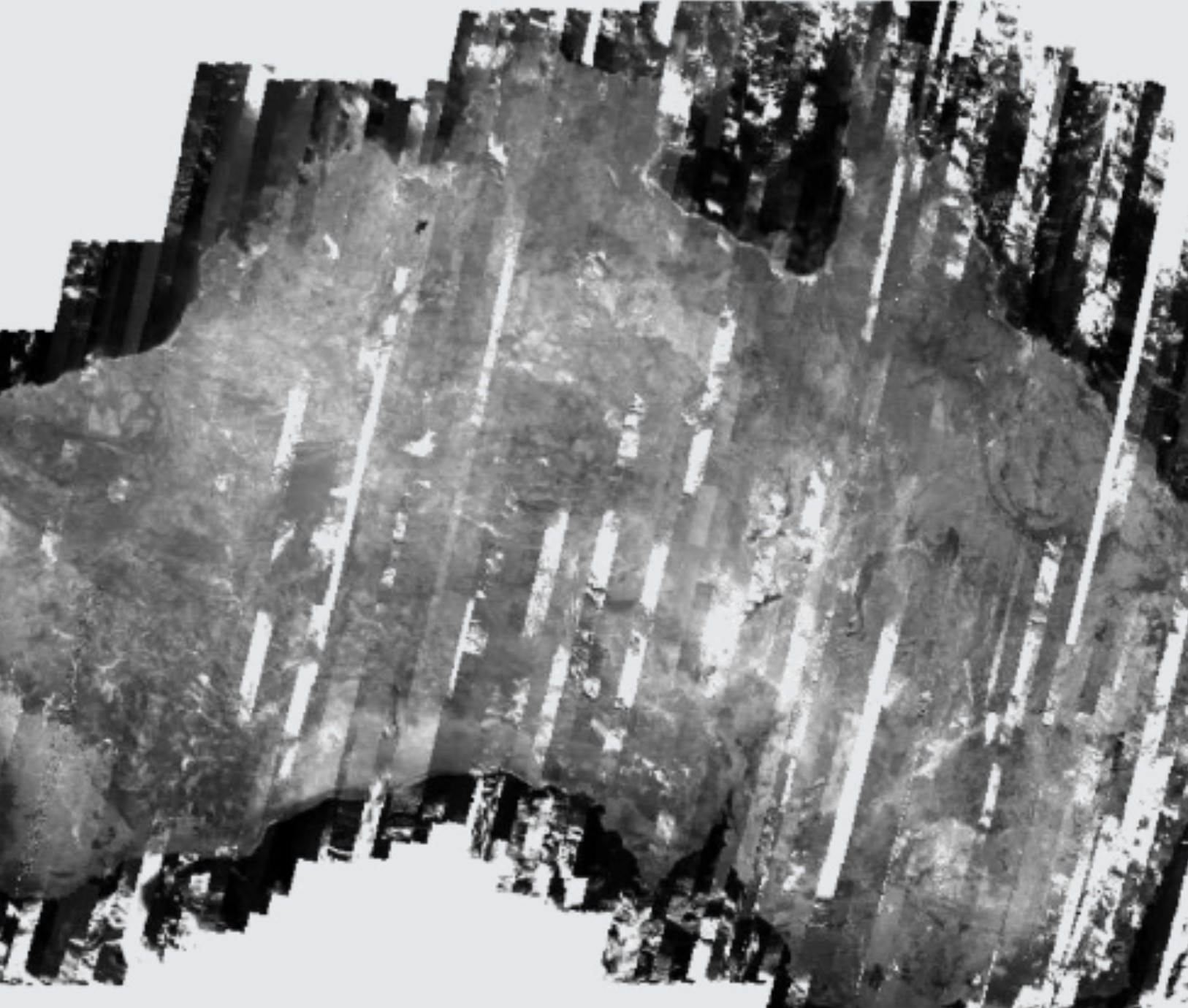
Australian Geographic Reference Image
Australian Geographic Reference Image
Australian Geographic Reference Image
- Version:
1.0.0 (Latest)
- Product types:
Baseline, Raster
- Update frequency:
None
- Next update:
No updates planned
About
The Australian Geographic Reference Image (AGRI) is a consistent and accurate reference image for rectification of imagery from multiple sources at resolutions of 2.5 m or less.
Access the data
For help accessing the data, see the Access tab.
Access the data on NCI
Key details
DOI |
|
Licence |
Cite this product
Data citation |
Geoscience Australia, 2011. AGRI: The Australian Geographic Reference Image. Geoscience Australia, Canberra. http://dx.doi.org/10.4225/25/5524BA4A047FE
|
Publications
Lewis, A., Wang, L.-W., Coghlan, R. (2011). AGRI: The Australian Geographic Reference Image. Geoscience Australia Technical Report. http://dx.doi.org/10.4225/25/5524BA4A047FE
Ravanbakhsh, M., Wang, L.-W., Fraser, C. S., & Lewis, A. (2012). Generation of the Australian Geographic Reference Image Through Long-Strip Alos Prism Orientation. ISPRS - International Archives of the Photogrammetry, Remote Sensing and Spatial Information Sciences, 39B1, 225–229. https://doi.org/10.5194/isprsarchives-XXXIX-B1-225-2012
Background
It is important to ensure that satellite images are consistently and accurately registered to allow the maximum extraction of information.
What this product offers
The Australian Geographic Reference Image (AGRI) is a consistent and accurate reference image for rectification of imagery from multiple sources at resolutions of 2.5 m or less.
The AGRI provides a consistent base image intended, at the time of production, to provide an important foundation for future mapping and monitoring across Australia.
Applications
The AGRI is a resource for both users and providers of satellite imagery covering Australia in:
Government agencies — Commonwealth, State and Local
Research institutions
Spatial Information Industry
International satellite operators
Ground Control Points from the AGRI have fed into satellite image processing systems of the United States Geological Survey and of the European Space Agency. Consequently, imagery from the Landsat satellites and from the Copernicus Sentinel satellites are accurately and consistently geo-registered across Australia.
Similarly, commercial satellite operators are understood to have used the AGRI to improve their product quality.
Reference image — image to image rectification, image chip source, quality control layer.
Basemap — feature revision and verification, reference layer.
Technical information
National mosaic — 10m georeferenced image
UTM zone mosaics — 2.5m georeferenced images
Ground Control Point spatial database
Ground Control Point ancillary data (photographs, site sketches and image chips).
Lineage
The Australian Geographic Reference Image (AGRI) is a consistent and accurate reference image for rectification of imagery from multiple sources at resolutions of 2.5 metres or less. The AGRI is needed because the emerging new satellites and other sources of imagery will generate increasing amounts of data. The AGRI can ensure that images from these sources are consistently and accurately registered to allow the maximum extraction of information.
During compilation more than 9560 satellite scenes, totalling over 6 terabytes, were used to produce eight mosaics, covering each of Australia’s Universal Transverse Mercator map zones. These mosaics were then combined to produce a single mosaic covering the Australian continent. Intensity and contrast balancing were used to ensure visual consistency across the mosaic while maintaining the dynamic range of the image.
The AGRI was made possible by new scientific and technical capabilities, international collaboration, the Australian spatial information industry, and the leadership and capabilities of Geoscience Australia. Japan’s Advanced Land Observing Satellite (ALOS) made possible the complete coverage of high quality imagery, which forms the foundation of the AGRI, as well as accurate data on the satellite orbit. Geoscience Australia was an international collaborator on the ALOS; handling data for the Oceania region. The Barista software, developed by the Cooperative Research Centre for Spatial Information, made the project feasible in terms of time, logistics, and cost. Barista reduced the image registration problem from correction of almost 10 000 scenes to correction of just 105 orbit segments (Lewis et al, 2011).
The expertise and capability of the Australian spatial information industry was used in the design of GIS databases to manage the survey data and to conduct the many field surveys to remote areas of Australia. The expertise and capabilities of Geoscience Australia staff in both Earth observation and geodesy were also essential inputs to the project (Lewis et al, 2011).
Processing steps
See the product description and technical report for the detailed methodology (doi:10.4225/25/5524BA4A047FE).
References
Lewis, A., Wang, L.-W., Coghlan, R. (2011). AGRI: The Australian Geographic Reference Image. Geoscience Australia Technical Report. http://dx.doi.org/10.4225/25/5524BA4A047FE
Ravanbakhsh, M., Wang, L.-W., Fraser, C. S., & Lewis, A. (2012). Generation of the Australian Geographic Reference Image through long-strip ALOS PRISM orientation. ISPRS - International Archives of the Photogrammetry, Remote Sensing and Spatial Information Sciences, XXXIX-B1, 225–229. https://doi.org/10.5194/isprsarchives-XXXIX-B1-225-2012
Rottensteiner, F., Weser, T., Lewis, A., & Fraser, C. S. (2009). A strip adjustment approach for precise georeferencing of ALOS optical imagery. IEEE Transactions on Geoscience and Remote Sensing, 47(12), 4083–4091. https://doi.org/10.1109/TGRS.2009.2014366
Accuracy
Absolute geometric accuracy: 5.6m CEP90.
Cloudy over some areas.
Quality assurance
Independent check points from GPS survey.
Access the data
Get the data online |
Learn how to access the data via AWS |
Access the product description and technical reports
A product description and technical report are available to download via the Geoscience Australia website. See doi:10.4225/25/5524BA4A047FE
Old versions
No old versions available.
License and copyright
© Commonwealth of Australia (Geoscience Australia).
Released under Creative Commons Attribution 4.0 International Licence.