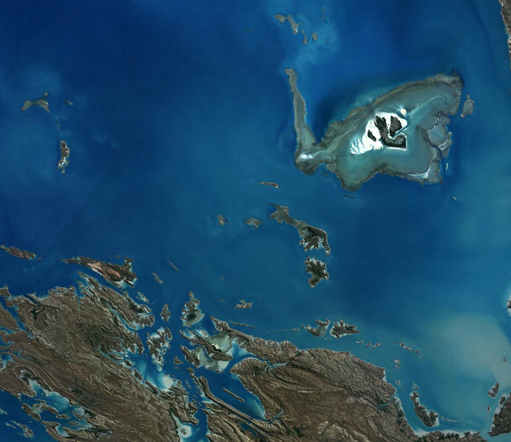
DEA High and Low Tide Imagery (Landsat)
DEA High and Low Tide Imagery (Landsat)
High Tide and Low Tide Composites 25m 2.0.0
- Version:
2.0.0 (Latest)
- Product types:
Derivative, Raster
- Time span:
1995 – 2017
- Update frequency:
As needed
- Next update:
No updates planned
- Product IDs:
high_tide_comp_20p, low_tide_comp_20p
About
Digital Earth Australia (DEA) High and Low Tide Imagery provides cloud-free imagery mosaics of Australia’s coast, estuaries and reefs at low and high tide, calculating the geometric median of the highest and lowest 20% of tides seen by Landsat satellites over decades.
Access the data
For help accessing the data, see the Access tab.
High tide data explorer
Low tide data explorer
Access the data on NCI
Code examples
Web Map Service (WMS)
Key details
Parent product(s) |
Landsat 5, 7 and 8 NBAR and Observational Attributes (Collection 2) |
Collection |
Geoscience Australia Landsat Collection 2 |
DOI |
|
Licence |
Cite this product
Data citation |
Sagar, S., Phillips, C., Bala, B., Roberts, D., Lymburner, L., 2017. High tide and low tide composites 25m v. 2.0.0. Geoscience Australia, Canberra. http://dx.doi.org/10.4225/25/5a615705d20f7
|
Paper citation |
Sagar, S., Phillips, C., Bala, B., Roberts, D., Lymburner, L., 2018. Generating continental scale pixel-based surface reflectance composites in coastal regions with the use of a multi-resolution tidal model. Remote Sensing. 10, 480. https://doi.org/10.3390/rs10030480
|
Publications
Sagar, S., Phillips, C., Bala, B., Roberts, D., & Lymburner, L. (2018). Generating Continental Scale Pixel-Based Surface Reflectance Composites in Coastal Regions with the Use of a Multi-Resolution Tidal Model. Remote Sensing, 10, 480. https://doi.org/10.3390/rs10030480
Background
Intertidal zones are those which are exposed to the air at low tide and underwater at high tide. These include sandy beaches, tidal flats, rocky shores and reefs.
Intertidal zones form critical habitats for a wide range of organisms, but are faced with increasing threats, including coastal erosion and a rise in sea levels.
The ever-changing nature of the tides makes it hard to systematically capture consistent imagery of the intertidal zone, particularly across large regions. Pressure is mounting on this zone from sea-level rise and anthropogenic sources such as land reclamation and aquaculture.
What this product offers
This product is a suite of cloud-free composite imagery of the intertidal zones at high and low tide around the Australian coast. It calculates the geometric median (geomedian) of the highest and lowest 20% of the observed tidal range in Digital Earth Australia (DEA)’s archive of Landsat satellite images.
To generate these composites, the archive of Landsat images has been paired with regional tidal modelling, generated by Oregon State Tidal Prediction software. This allows the archive to be sorted by tide height rather than date, so the intertidal zone can be visualised at any stage of the tide regime.
The data has been captured on a 25m spatial scale.
Applications
Mapping cover types within the intertidal zone
Visualising the full observed extent of the tidal range around the Australian continental coastline
Technical information
Inter-tidal zones are difficult regions to characterise due to the dynamic nature of the tide. They are highly changeable environments, subject to forcings from the land, sea and atmosphere and yet they form critical habitats for a wide range of organisms from birds to fish and sea grass. By harnessing the long archive of satellite imagery over Australia’s coastal zones in the DEA and pairing the images with regional tidal modelling, the archive can be sorted by tide height rather than date, enabling the inter-tidal zone to be viewed at any stage of the tide regime.
The High Low Tide Composites (HLTC_25) product is composed of two mosaics, distinguished by tide height, representing a composite image of the synthetic geomedian surface reflectance from Landsats 5 TM, Landsat 7 ETM+ and Landsat 8 OLI NBAR data (Li et al., 2012; Roberts et al., 2017). These products have been produced using Digital Earth Australia (DEA). The two mosaics allow cloud free and noise reduced visualisation of the shallow water and inter-tidal coastal regions of Australia, as observed at high and low tide respectively (Sagar et al., 2018).
The composites are generated utilising the geomedian approach of Roberts et al (2017) to ensure a valid surface reflectance spectra suitable for uses such as habitat mapping. The time range used for composite generation in each polygon of the mosaic is tailored to ensure dynamic coastal features are captured whilst still allowing a clean and cloud free composite to be generated. The concepts of the Observed Tidal Range (OTR), and Highest and Lowest Observed Tide (HOT, LOT) are discussed and described fully in Sagar et al. (2017) and the product description for the ITEM v 1.0 product (Geoscience Australia, 2016).
Oregon State Tidal Prediction (OTPS) software (Egbert and Erofeeva, 2002, 2010) was used to generate tide heights, relative to mean sea level, for the Australian continental coastline, split into 306 distinct tidal regions. These time and date stamped tidal values were then attributed to all coastal tile observations for their time of acquisition, creating a range of observed tide heights for the Australian coastline. The two mosaics in HLTC_25 are composited from the highest and lowest 20 % of observed tide in the ensemble and are termed HOT and LOT respectively. A geomedian composite for each Landsat band is calculated from the tiles in each ensemble subset to produce the respective HOT and LOT composites (Sagar et al., 2018). Note that Landsat 7 ETM+ observations are excluded after May 2003 due to a large number of data artefacts.
The time range used for composite generation in each of the 306 polygons of the mosaics is tailored to ensure dynamic coastal features are captured whilst still allowing a clean and cloud free composite to be generated. The maximum epoch for which the products are calculated is between 1995-2017, although this varies due to data resolution and observation quality. The product also includes a count of clear observations per pixel for both mosaics.
Observations are filtered to remove poor quality observations including cloud, cloud shadow and band saturation (of any band).
Features
The High and Low Tide Composites product is a 6-band mosaic, consistent with Landsat, produced to allow visualisation of the shallow water and inter-tidal coastal regions as observed at high or low tide. It is continental (coastal) in coverage and includes geomedian surface reflectance, along with pixel and polygon level metadata for each of the 306 polygons contained in each of the HOT and LOT mosaics.
The supporting polygon level metadata includes the following attributes:
ID |
polygon ID number |
lon |
polygon centroid longitude |
lat |
polygon centroid latitude |
date_range |
range of input dates |
modelLow |
lowest modelled tide height between the input dates |
modelHigh |
highest modelled tide height between the input dates |
MaximumObs |
maximum count of clear observations for any pixel in the polygon |
LIT |
lowest input tide height to the composite image |
HIT |
highest input tide height to the composite image |
stages |
the count of each observed tide stage in the composite image. Where: |
The tide stages were calculated by comparison to the modeled tide data for 15 minutes either side of the observation to determine the ebb, flow or peak movement of the tide.
The composites file naming convention is as follows:
COMPOSITE_[HIGH or LOW]_[polygon ID]_[centroid longitude]_[centroid latitude]_[input date range]_PER_20.[nc or tif]
e.g. COMPOSITE_HIGH_297_120.3_-19.36_20000101_20170101_PER_20.nc
The maximum pixel count naming convention is as follows:
COUNT_[HIGH or LOW]_[polygon ID]_[centroid longitude]_[centroid latitude]_[input date range]_PER_20.[nc or tif]
e.g. COUNT_HIGH_297_120.3_-19.36_20000101_20170101_PER_20.nc
Lineage
The product has been developed to provide a geomedian composite visualisation of coastal regions of Australia for the highest and lowest 20% of the observed tidal range in the Landsat catalogue. Coastal Landsat observations are composited relative to tidal modelling of the Australian coastline (split into 306 polygons, characterised by similar tidal characteristics) using Oregon State Tidal Prediction Software (OTPS, Egbert and Erofeeva, 2002, 2010)).
Processing steps
1. Create a continental scale tidal modelling framework
Create a continental scale tidal modelling framework utilising continental scale tidal prediction software developed by Oregon State University (OTPS, Egbert and Erofeeva, 2002, 2010). OTPS tide heights were attributed to Landsat observations in the DEA at corresponding times and dates, per location
The modelling process utilises continental scale tidal prediction software developed by Oregon State University (OTPS, Egbert and Erofeeva, 2002, 2010). OTPS tide heights were attributed to Landsat observations in the DEA at corresponding times and dates, per location.
To account for geographic and seasonal variations in tidal regimes and ranges, twelve tidal height rasters of the study region at 1km resolution were created utilising the OTPS model, at a randomly selected monthly epoch across a full year. Utilising these raster layers, the tidal modelling spatial framework was constructed with the following steps:
Perform a multi-resolution segmentation using eCognition software, utilising all twelve tidal height inputs, to create a spatial representation of the multi-epoch tidal variation across the continent.
Extract the centroids of the object segments created in eCognition and generate a Voronoi Polygon tessellation of the region.
Perform a visual assessment and manual adjustment of the Voronoi polygon boundaries and nodes to ensure alignment with natural boundaries and coastal/island features.
Through this process, the coastal zone is divided into Voronoi polygons that capture the tidal complexity of the Australian coast, with areas of complex tidal behaviour represented using smaller polygons. The nodes of the polygons can then be used for the tidal attribution process as described in Sagar et al., (2017).
2. Generate HOT and LOT composite imagery
Generate HOT and LOT composite imagery: Landsat TM and OLI NBAR extracted for each tidal model polygon for 2010-17 range; pixel filtered; tagged and sorted by tidal height (OTPS); pixel based geomedian composites created from HT and LT composite subsets.
The high and low tide composite generation comprises the following steps:
Landsat TM and OLI NBAR time-series observations archived in the DEA are extracted for each tidal model polygon for the 2010-17 time range..
Data is then filtered on a pixel basis to remove poor quality data including cloud, cloud shadow and band saturation.
Observations are tagged with a tidal height relative to Mean Sea Level (MSL) utilising the OTPS model, time of acquisition and location of the polygon model node.
Observations are sorted by tidal height to allow identify subsets acquired at high and low tide:
the lower 20th percentile of the observed tidal range, which are used to calculate the low tide composite, and,
the upper 20th percentile of the observed tidal range which are used to calculate the high tide composite.
Pixel based geomedian composites are then created from the high and low tide composite subsets.
The composite is visually inspected to assess the quality (ie. remnant cloud noise, lack of data). If required, steps 1-5 are then repeated with an additional 5 years of archival data added to the process. Ultimately, highest observed tide (HOT) composites ranged from either 1995-17 or 2000-17 per polygon. Lowest observed tide (LOT) composites ranged from either 2000-17, 2005-17 or 2010-17 per polygon.
Due the sun-synchronous nature of the various Landsat sensor observations; it is unlikely that the full physical extents of the tidal range in any cell will be observed. Hence, terminology has been adopted for the product to reflect the highest modelled tide observed in a given cell (HOT) and the lowest modelled tide observed (LOT). These measures are relative to Mean Sea Level, and have no consistent relationship to Lowest (LAT) and Highest Astronomical Tide (HAT).
References
Egbert, G. D., & Erofeeva, S. Y. (2002). Efficient Inverse Modeling of Barotropic Ocean Tides. Journal of Atmospheric and Oceanic Technology, 19(2), 183–204. https://doi.org/10.1175/1520-0426(2002)019<0183:EIMOBO>2.0.CO;2
Egbert, G.D., Erofeeva, S.Y., 2010. The OSU TOPEX/Poseiden Global Inverse Solution TPXO [WWW Document]. TPXO8-Atlas Version 10. URL http://volkov.oce.orst.edu/tides/global.html (accessed 2.15.16).
Li, F., Jupp, D. L. B., Thankappan, M., Lymburner, L., Mueller, N., Lewis, A., & Held, A. (2012). A physics-based atmospheric and BRDF correction for Landsat data over mountainous terrain. Remote Sensing of Environment, 124, 756–770. https://doi.org/10.1016/j.rse.2012.06.018
Roberts, D., Mueller, N., & Mcintyre, A. (2017). High-Dimensional Pixel Composites From Earth Observation Time Series. IEEE Transactions on Geoscience and Remote Sensing, 55(11), 6254–6264. https://doi.org/10.1109/TGRS.2017.2723896
Rubel, F., & Kottek, M. (2010). Observed and projected climate shifts 1901-2100 depicted by world maps of the Köppen-Geiger climate classification. Meteorologische Zeitschrift, 19, 135–141. https://doi.org/10.1127/0941-2948/2010/0430
Sagar, S., Phillips, C., Bala, B., Roberts, D., & Lymburner, L. (2018). Generating Continental Scale Pixel-Based Surface Reflectance Composites in Coastal Regions with the Use of a Multi-Resolution Tidal Model. Remote Sensing, 10, 480. https://doi.org/10.3390/rs10030480
Sagar, S., Roberts, D., Bala, B., & Lymburner, L. (2017). Extracting the intertidal extent and topography of the Australian coastline from a 28year time series of Landsat observations. Remote Sensing of Environment, 195, 153–169. https://doi.org/10.1016/j.rse.2017.04.009
Accuracy
The accuracy of the tide height data is limited by the accuracy of the OTPS model. Tidal modelling on self-similar coastal polygons was performed to minimise regional uncertainty.
Accuracies and limitations related to geomedian compositing of observations are discussed in Roberts et al (2017).
Users should beware of seasonal and diurnal effects in the imagery, especially in the north east of Australia where the footprint of the highest and lowest astronomical tides are large. Consequently, where image acquisition misses the highest astronomical tide, for example, pooling effects of water are still visible in the landscape in lowest observed tidal composite imagery.
This product has been rendered in both true colour and false colour. Validation and interpretation of surface features has not been attempted here. Interpretation of surface features is at the users own discretion.
Quality assurance
E-cognition was used to distribute the Australian coastline into 306 self similar polygons in terms of tidal characteristics, from which OTPS tidal modelling of the centroid was used to tide tag all Landsat observations occurring within that polygon. This process was identical to that used in the generation of ITEM v 2.0.0
A geomedian compositing process (Roberts et al., 2017) was used to ensure a valid surface reflectance spectra was generated for nominated subsets of the observed tidal range.
Climate based testing was undertaken to determine the best percentage of high and low tide tagged observations to include into a continental composite image. Seventeen Koppen climate zones (Rubel and Kottek, 2010) across Australia were tested to account for variability in features including cloud cover and glint. Seasonal signatures were identified in some northern parts of Australia due to the sun synchronous nature of Landsat image acquisition. Southern parts of the Australian coastline, including western Tasmania, Victoria and south Western Australia, were affected by low sun-angle and consequently, produce darker composites compared to the north. Considering this, the highest and lowest 20 % of observed tides were selected as the values to best represent the end-members of the Australian inter-tidal zone.
To minimise the smoothing of coastal features due to large data sets, the time range for inclusion of observations into the composite products was likewise minimised. Typically, the optimal time-range for a polygon composite ranged from 2000 to 2017. In polygons with a high count of valid observations, the time-range was reduced to 2010 to 2017. Where the polygon had a low count of valid observations, the time range was extended to 1995 - 2017. The decision to lengthen or shorten the time range for data inclusion in a polygon was made by visual observation of the quality of the geomedian composite and reference to the pixel count of valid observations for each polygon. Images affected by cloud, cloud shadow or an absence of data were associated with low or zero pixel counts. In these situations, the time range was extended. Where pixel counts indicated a high number of valid observations, the time range was lowered. Typically, this occurred in areas including north west Western Australia.
Access the data
Explore data availability |
Learn how to use the DEA Explorer |
|
Get the data online |
Learn how to access the data via AWS |
|
Code sample |
Learn how to use the DEA Sandbox |
|
Get via web service |
Learn how to use DEA’s web services |
How to view the data in a web map
To view and access the data interactively:
Visit DEA Maps.
Click
Explore map data.Select
Sea, ocean and coast>DEA High and Low Tide Imagery (HLTC)>DEA Low Tide Imagery (Landsat).Click
Add to the map, or the+symbol to add the data to the map.Select
Sea, ocean and coast>DEA High and Low Tide Imagery (HLTC)>DEA High Tide Imagery (Landsat).Click
Add to the map, or the+symbol to add the data to the map.
Old versions
No old versions available.
Acknowledgments
Landsat data is provided by the United States Geological Survey (USGS) through direct reception of the data at Geoscience Australia’s satellite reception facility or download.
License and copyright
© Commonwealth of Australia (Geoscience Australia).
Released under Creative Commons Attribution 4.0 International Licence.