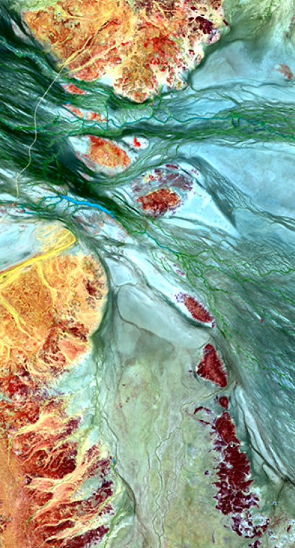
DEA Surface Reflectance (Landsat 5 TM)
DEA Surface Reflectance (Landsat 5 TM)
Geoscience Australia Landsat 5 TM Analysis Ready Data Collection 3
- Version:
3.0.0 (Latest)
- Product types:
Baseline, Raster
- Time span:
16/08/1986 – 17/11/2011
- Update frequency:
Daily
- Product ID:
ga_ls5t_ard_3
About
DEA Surface Reflectance (Landsat 5 TM) is part of a suite of Digital Earth Australia (DEA)’s Surface Reflectance datasets that represent the vast archive of images captured by the US Geological Survey (USGS) Landsat and European Space Agency (ESA) Sentinel-2 satellite programs, validated, calibrated, and adjusted for Australian conditions — ready for easy analysis.
Access the data
For help accessing the data, see the Access tab.
Data explorer
Access the data on NCI
Access the data on AWS
Code examples
Key details
Collection |
Geoscience Australia Landsat Collection 3 |
Persistent ID |
|
Licence |
Cite this product
Data citation |
Fuqin, Li., Jupp, D.L.B., Sixsmith, J., Wang, L., Dorj, P., Vincent, A., Alam, I., Hooke, J., Oliver, S., Thankappan, M., 2019. GA Landsat 5 TM Analysis Ready Data Collection 3. Geoscience Australia, Canberra. https://pid.geoscience.gov.au/dataset/ga/130853
|
Publications
Li, F., Jupp, D. L. B., Reddy, S., Lymburner, L., Mueller, N., Tan, P., & Islam, A. (2010). An evaluation of the use of atmospheric and BRDF correction to standardize Landsat data. IEEE Journal of Selected Topics in Applied Earth Observations and Remote Sensing, 3(3), 257–270. https://doi.org/10.1109/JSTARS.2010.2042281
Li, F., Jupp, D. L. B., Thankappan, M., Lymburner, L., Mueller, N., Lewis, A., & Held, A. (2012). A physics-based atmospheric and BRDF correction for Landsat data over mountainous terrain. Remote Sensing of Environment, 124, 756–770. https://doi.org/10.1016/j.rse.2012.06.018
Background
The United States Geological Survey’s (USGS) Landsat satellite program has been capturing images of the Australian continent for more than 30 years. This data is highly useful for land and coastal mapping studies.
In particular, the light reflected from the Earth’s surface (surface reflectance) is important for monitoring environmental resources – such as agricultural production and mining activities – over time.
We need to make accurate comparisons of imagery acquired at different times, seasons and geographic locations. However, inconsistencies can arise due to variations in atmospheric conditions, sun position, sensor view angle, surface slope and surface aspect. These need to be reduced or removed to ensure the data is consistent and can be compared over time.
What this product offers
This product takes Landsat 5 Thematic Mapper (TM) imagery captured over the Australian continent and corrects for inconsistencies across land and coastal fringes. The result is accurate and standardised surface reflectance data, which is instrumental in identifying and quantifying environmental change.
This product is a single, cohesive Analysis Ready Data (ARD) package, which allows you to analyse surface reflectance data as is, without the need to apply additional corrections.
It contains three sub-products that provide corrections or attribution information:
The resolution is a 30 m grid based on the USGS Landsat Collection 1 archive.
Applications
The development of derivative products to monitor land, inland waterways and coastal features, such as:
urban growth
coastal habitats
mining activities
agricultural activity (e.g. pastoral, irrigated cropping, rain-fed cropping)
water extent
The development of refined information products, such as:
area/units of detected surface water
area/units of deforestation
yield predictions of agricultural parcels
Compliance surveys
Emergency management
Technical information
The Thematic Mapper (TM) sensor
The TM is an advanced, multispectral scanning, Earth resources sensor which is designed to categorise the Earth’s surface. It is particularly useful for agricultural applications and identification of land use.
The Analysis Ready Data concept
The Analysis Ready Data (ARD) package allows you to get up and running with your analysis as quickly as possible with minimal data preparation and additional input. This makes it simpler for you to develop applications and for the database to execute queries.
The satellite data has been processed to a minimum set of requirements and organised into a form that allows immediate analysis and interoperability through time and with other datasets. It has been adapted from CEOS Analysis Ready Data (CARD4L).
The technical report containing the data summary for the Phase 1 DEA Surface Reflectance Validation is available.
ARD sub-products
DEA Surface Reflectance NBAR (Landsat 5 TM) This sub-product produces standardised optical surface reflectance data using robust physical models which correct for variations and inconsistencies in image radiance values. Corrections are performed using Nadir corrected Bi-directional reflectance distribution function Adjusted Reflectance (NBAR).
DEA Surface Reflectance NBART (Landsat 5 TM) This sub-product performs the same function as Surface Reflectance (Landsat 5 TM NBAR), but also applies terrain illumination correction.
The NBAR and NBART sibling products depend upon the OA product to provide accurate and reliable contextual information about the Landsat data. This ‘data provenance’ provides a chain of information which allows the data to be replicated or utilised by derivative applications. It takes a number of different forms, including satellite, solar and surface geometry and classification attribution labels.
Lineage
This product is derived from the USGS Landsat Collection 1 archive.
The Moderate Resolution Imaging Spectroradiometer (MODIS) MCD43A1 Version 6 Bidirectional Reflectance Distribution Function and Albedo (BRDF/Albedo) Model Parameters dataset was provided by the National Aeronautics and Space Administration (NASA). It was produced daily using 16 days of Terra and Aqua MODIS data at 500 m resolution. See USGS: MCD43A1, NASA: MODIS BRDF / Albedo Parameter, Schaaf et al. (2002)
The ozone data was provided by Environment Canada. See Environment Canada: Global Ozone Maps
The Aerosol Optical Thickness data was provided by the Commonwealth Scientific and Industrial Research Organisation (CSIRO). See Qin et al. (2015)
The Precipitable Water for Entire Atmosphere data was provided by the National Oceanic and Atmospheric Administration (NOAA) / Earth System Research Laboratory (ESRL) / Physical Sciences Division (PSD). See Kalnay et al. (1996)
The baseline Digital Surface Model (DSM) data produced from the Shuttle Radar Topography Mission (SRTM) was provided by the National Geospatial-Intelligence Agency (NGA). See NGA: SRTM, NASA: SRTM
Level 1 Collection 1 data was provided by the United States Geological Survey (USGS)’s Earth Resources Observation and Science (EROS) Center. See USGS: EROS, USGS: Landsat Collection 1
Processing steps
Longitude and Latitude Calculation
Satellite and Solar Geometry Calculation
Aerosol Optical Thickness Retrieval
BRDF Shape Function Retrieval
Ozone Retrieval
Elevation Retrieval and Smoothing
Slope and Aspect Calculation
Incidence and Azimuthal Incident Angles Calculation
Exiting and Azimuthal Exiting Angles Calculation
Relative Slope Calculation
Terrain Occlusion Mask
MODTRAN
Atmospheric Correction Coefficients Calculation
Bilinear Interpolation of Atmospheric Correction Coefficients
Surface Reflectance Calculation (NBAR)
Surface Reflectance Calculation (NBAR + Terrain Illumination Correction)
Function of Mask (Fmask)
Contiguous Spectral Data Mask Calculation
Software
References
Berk, A., Conforti, P., Kennett, R., Perkins, T., Hawes, F., & van den Bosch, J. (2014, June 13). MODTRAN6: A major upgrade of the MODTRAN radiative transfer code (M. Velez-Reyes & F. A. Kruse, Eds.). https://doi.org/10.1117/12.2050433
Dymond, J. R., & Shepherd, J. D. (1999). Correction of the topographic effect in remote sensing. IEEE Transactions on Geoscience and Remote Sensing, 37(5), 2618–2619. https://doi.org/10.1109/36.789656
Hudson, S. R., Warren, S. G., Brandt, R. E., Grenfell, T. C., & Six, D. (2006). Spectral bidirectional reflectance of Antarctic snow: Measurements and parameterization. Journal of Geophysical Research, 111(D18), D18106. https://doi.org/10.1029/2006JD007290
Kalnay, E., Kanamitsu, M., Kistler, R., Collins, W., Deaven, D., & Gandin, L. et al. (1996). The NCEP/NCAR 40-Year Reanalysis Project. Bulletin Of The American Meteorological Society, 77(3), 437-471. https://doi.org/10.1175/1520-0477(1996)077<0437:tnyrp>2.0.co;2
Li, F., Jupp, D. L. B., Reddy, S., Lymburner, L., Mueller, N., Tan, P., & Islam, A. (2010). An evaluation of the use of atmospheric and BRDF correction to standardize Landsat data. IEEE Journal of Selected Topics in Applied Earth Observations and Remote Sensing, 3(3), 257–270. https://doi.org/10.1109/JSTARS.2010.2042281
Li, F., Jupp, D. L. B., Thankappan, M., Lymburner, L., Mueller, N., Lewis, A., & Held, A. (2012). A physics-based atmospheric and BRDF correction for Landsat data over mountainous terrain. Remote Sensing of Environment, 124, 756–770. https://doi.org/10.1016/j.rse.2012.06.018
Qin, Y., Mitchell, R., & Forgan, B. W. (2015). Characterizing the aerosol and surface reflectance over Australia using AATSR. IEEE Transactions on Geoscience and Remote Sensing, 53(11), 6163–6182. https://doi.org/10.1109/TGRS.2015.2433911
Schaaf, C., Gao, F., Strahler, A., Lucht, W., Li, X., & Tsang, T. et al. (2002). First operational BRDF, albedo nadir reflectance products from MODIS. Remote Sensing Of Environment, 83(1-2), 135-148. https://www.doi.org/10.1016/s0034-4257(02)00091-3
SZA. (2011). Retrieved May 2019, from http://sacs.aeronomie.be/info/sza.php
Zhu, Z., Wang, S., & Woodcock, C. (2015). Improvement and expansion of the Fmask algorithm: cloud, cloud shadow, and snow detection for Landsats 4–7, 8, and Sentinel 2 images. Remote Sensing Of Environment, 159, 269-277. https://doi.org/10.1016/j.rse.2014.12.014
Zhu, Z., & Woodcock, C. E. (2012). Object-based cloud and cloud shadow detection in Landsat imagery. Remote Sensing of Environment, 118, 83–94. https://doi.org/10.1016/j.rse.2011.10.028
Accuracy
For detailed information on accuracy and limitations, refer to the sub-products’ pages:
Quality assurance
For detailed information on quality assurance, refer to the sub-products’ pages:
The technical report containing the data summary for the Phase 1 DEA Surface Reflectance Validation is available.
Access the data
Explore data availability |
Learn how to use the DEA Explorer |
|
Get the data online |
Learn how to access the data via AWS |
|
Code sample |
Learn how to use the DEA Sandbox |
Old versions
View previous versions of this data product.
Acknowledgments
This research was undertaken with the assistance of resources from the National Computational Infrastructure (NCI), which is supported by the Australian Government.
Landsat level 0 and level 1 data courtesy of the U.S. Geological Survey.
The authors would like to thank the following organisations:
National Aeronautics and Space Administration (NASA)
Environment Canada
The Commonwealth Scientific and Industrial Research Organisation (CSIRO)
National Oceanic and Atmospheric Administration (NOAA) / Earth System Research Laboratories (ESRL) / Physical Sciences Laboratory (PSD)
The National Geospatial-Intelligence Agency (NGA)
The United States Geological Survey (USGS) / Earth Resources Observation and Science (EROS) Center
Spectral Sciences Inc.
License and copyright
© Commonwealth of Australia (Geoscience Australia).
Released under Creative Commons Attribution 4.0 International Licence.